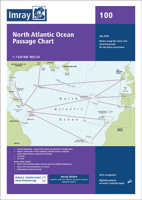
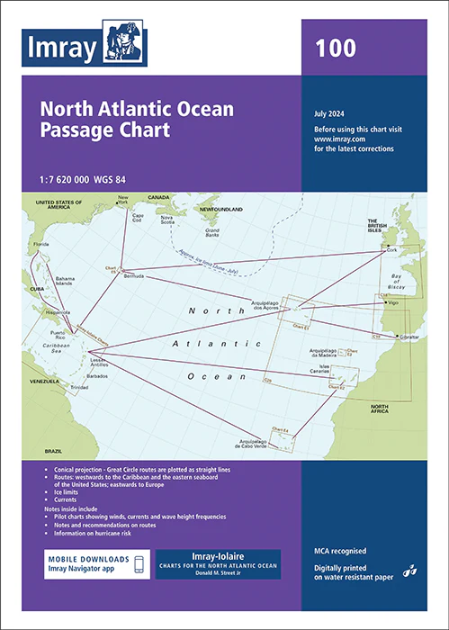
Ocean Passage Maps: A Crucial Resource for Safe Sea Voyage Planning
# Ocean Passage Maps: A Crucial Resource for Safe Sea Voyage Planning When it comes to planning a sea voyage, there’s no room for guesswork. Whether you’re an experienced sailor or just starting out, ocean passage maps play an essential role in ensuring a safe and successful journey across the vast seas. These maps provide…