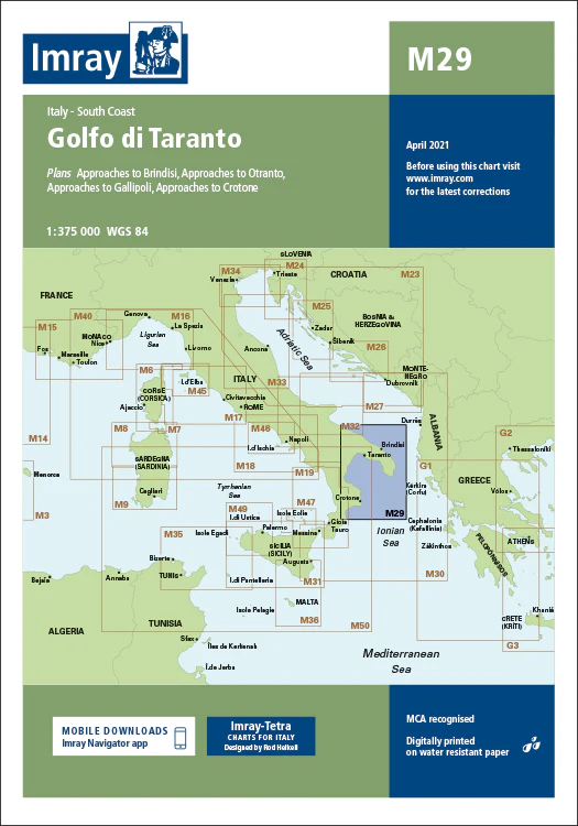
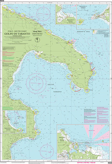
Description
Imray Chart M29 Golfo di Taranto – Your Trusted Guide for Navigating the Gulf of Taranto
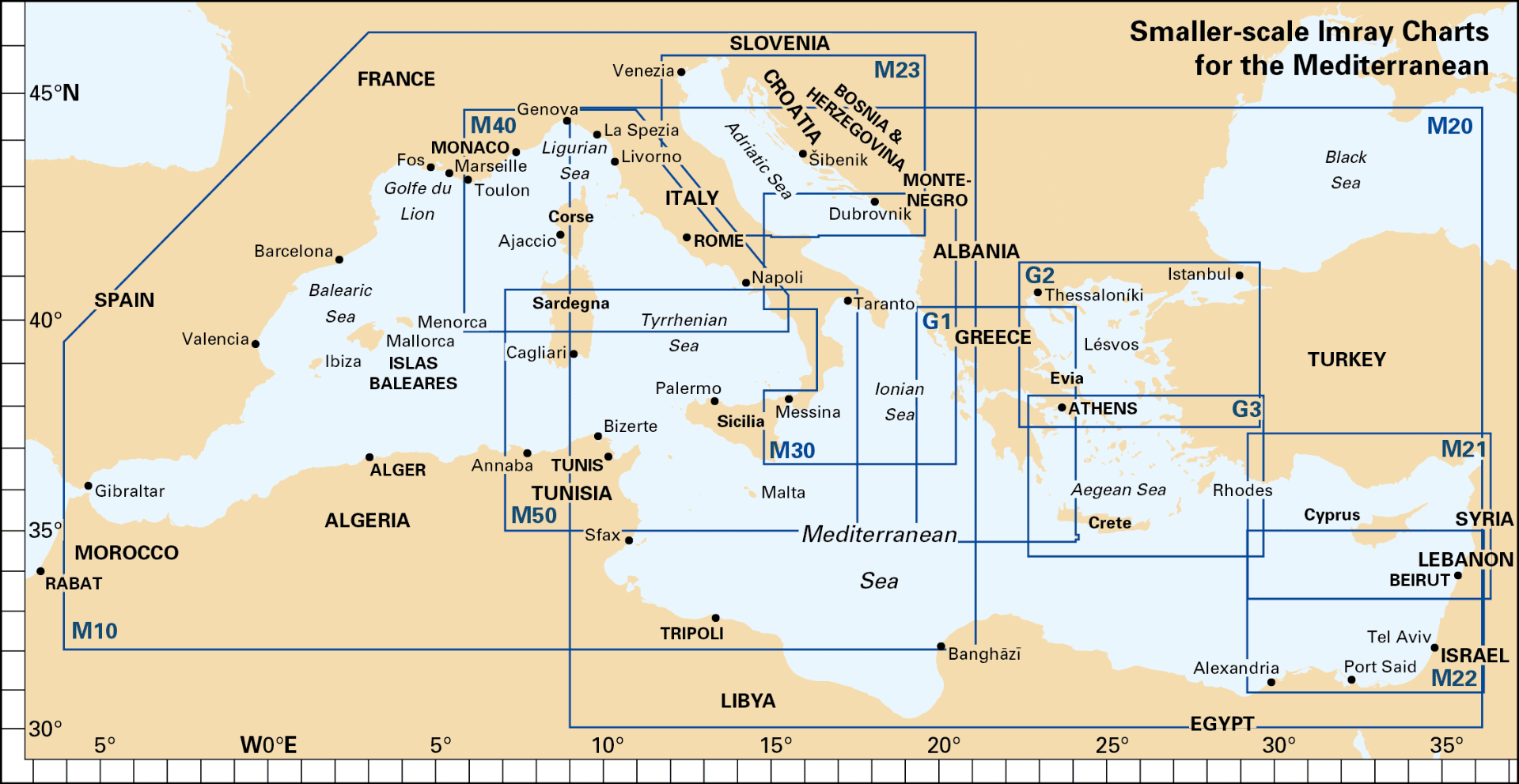
Explore the beautiful and historic waters of southern Italy with the Imray Chart M29 Golfo di Taranto. This highly detailed navigational chart is an indispensable tool for sailors, yachters, and cruisers traveling through the Gulf of Taranto. Covering the expansive coastal waters between the regions of Calabria, Basilicata, and Puglia, this chart ensures you have the most accurate and up-to-date information for safe and efficient navigation.
Key Features:
- Extensive Coverage: Offers comprehensive mapping of the Gulf of Taranto, including detailed coastal features, ports, and anchorages from Calabria to Puglia.
- Precision Navigational Data: Includes critical details such as soundings, tidal streams, and identified hazards, providing everything needed for safe passage through these Mediterranean waters.
- Trusted Imray Cartography: Known for its accuracy and clarity, Imray’s expert cartography ensures reliable navigation, making it easier to plot your course with confidence.
- Marine-Grade Durability: Printed on water-resistant, tear-proof paper, this chart is designed to withstand the demands of marine environments, ensuring long-lasting use.
- Updated Information: Incorporates the latest navigational updates, giving you the most current and reliable data for your journey.
Why Choose Imray Chart M29?
- Unmatched Accuracy: Imray charts are recognized worldwide for their precision, making them the preferred choice for mariners seeking reliable navigational aids.
- Enhanced Safety: The chart provides detailed and essential information to help you avoid navigational hazards, find secure anchorages, and make informed decisions, ensuring a safer and smoother sailing experience.
- Ideal for Passage Planning: Perfect for planning coastal passages or longer cruises through the Gulf of Taranto, offering thorough and detailed guidance for successful navigation.
- User-Friendly Layout: Designed for easy use, even under challenging conditions, with a clear and well-organized layout that helps you navigate confidently.
Ideal For:
- Sailors & Yachters: A must-have for those navigating the Gulf of Taranto, offering detailed and reliable information on the region’s coastal waters.
- Mediterranean Cruisers: Perfect for anyone exploring southern Italy’s coastline, providing all the necessary data for a safe and enjoyable journey.
- Coastal Explorers: Ideal for planning trips along Italy’s Ionian coast, ensuring you have the most up-to-date and accurate navigational information.
Navigate the stunning Gulf of Taranto with confidence using the Imray Chart M29 Golfo di Taranto. Order now to ensure your sailing adventures are supported by the most precise and comprehensive chart available for this iconic Mediterranean region.
Plans included:
- Approaches to Brindisi (1:35 000)
- Approaches to Otranto (1:15 000)
- Approaches to Gallipoli (1:30 000)
- Approaches to Crotone (1:100 000)
For this 2015 edition the chart has been fully updated throughout. The amended TSS at Brindisi is now displayed.
PRODUCT INFORMATION
- Stock code: ICM29-2
- Author: Imray M Series
- Publication details: 640 x 900mm folded to A4, Water-resistant paper chart in plastic wallet or flat on request
- Edition date: 2015
- Printed and updated to: April 2023
- ISBN: 9781846236945
Reviews
There are no reviews yet.