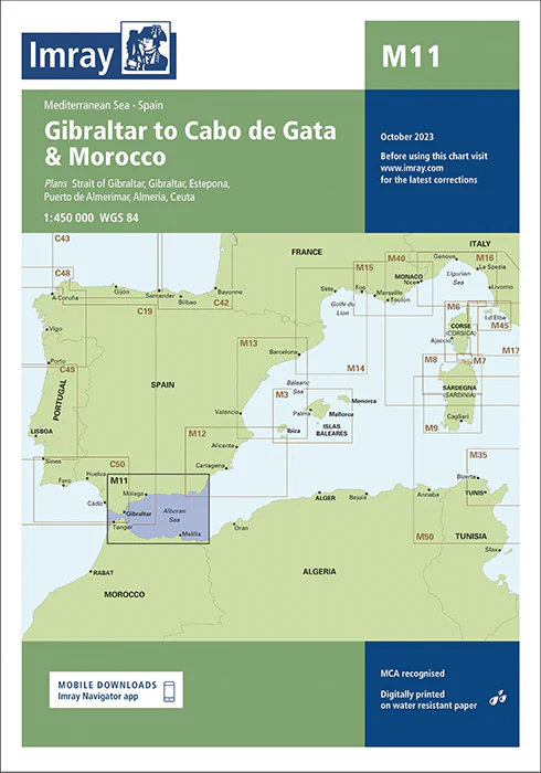
Description
Imray Chart M11 Gibraltar to Cabo de Gata and Morocco – Navigate the Western Mediterranean and North African Coasts with Precision
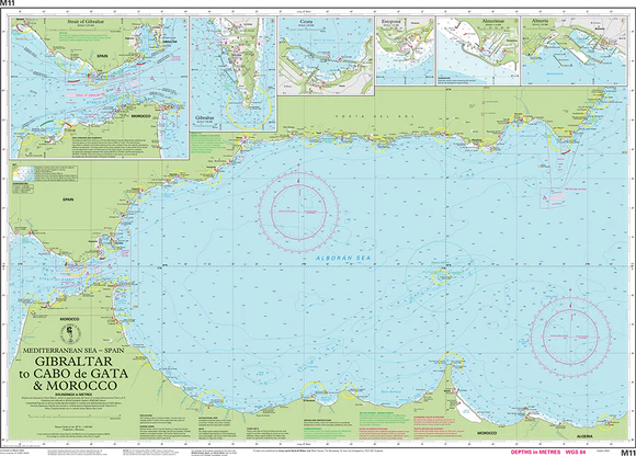
Embark on your maritime journey with confidence using the Imray Chart M11 Gibraltar to Cabo de Gata and Morocco. This essential chart is designed for sailors, yachters, and cruisers navigating the diverse and scenic waters from Gibraltar through the Western Mediterranean, including the Spanish coastline, and extending to the coast of Morocco. Whether you’re exploring historic ports, pristine anchorages, or dynamic coastal regions, this chart provides the detailed navigational information you need for a successful voyage.
Key Features:
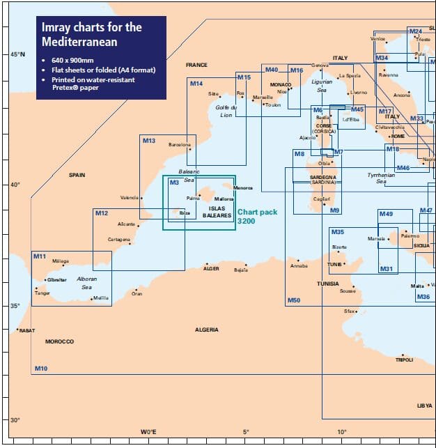
- Extensive Coverage: Detailed mapping from Gibraltar, covering the coastlines of Spain, including Cabo de Gata, and extending to the Moroccan coast. Includes key ports, harbors, and notable cruising areas throughout this vital maritime corridor.
- Accurate Navigational Data: Provides crucial information such as soundings, tidal streams, navigational hazards, and coastal features to ensure safe and efficient navigation through both busy and remote waters.
- Imray Cartography: Known for its precision and clarity, Imray charts offer reliable and comprehensive information that mariners depend on for effective route planning and navigation.
- Durable Marine-Grade: Printed on water-resistant and tear-proof paper, designed to withstand the marine environment, ensuring long-lasting durability and repeated use.
- Up-to-Date Information: Features the latest navigational updates and changes, delivering current and relevant data for your maritime adventures in the Western Mediterranean and North Africa.
Why Choose Imray Chart M11?
- Accuracy and Reliability: Imray charts are globally respected for their accuracy, making them the top choice for mariners who need dependable navigational tools for complex and varied waters.
- Enhanced Safety: Detailed charts help you avoid hazards, locate safe anchorages, and navigate intricate coastal routes with confidence and ease.
- Ideal for Mediterranean and North African Cruising: Perfect for planning voyages from Gibraltar to the Moroccan coast and along the Spanish and Mediterranean coasts, offering comprehensive coverage of key ports and scenic areas.
- User-Friendly Design: Features a clear and well-organized layout, ensuring ease of use even in challenging conditions, and allowing for quick and effective navigation.
Perfect For:
- Sailors & Yachters: Essential for navigating from Gibraltar to Cabo de Gata and Morocco, providing detailed charts of important ports and coastal regions.
- Mediterranean and North African Explorers: Ideal for those venturing through the Western Mediterranean and along the North African coast, offering accurate and reliable information for a smooth voyage.
- Maritime Enthusiasts: Perfect for anyone planning to explore this diverse and beautiful region, ensuring you have up-to-date and comprehensive navigational data.
Navigate the varied and captivating waters from Gibraltar to Morocco with the Imray Chart M11 Gibraltar to Cabo de Gata and Morocco. Order now to equip yourself with the most accurate and reliable chart available for your maritime explorations in this remarkable region.
Plans included:
- Strait of Gibraltar (1:275 000)
- Gibraltar (1:50 000)
- Estepona (1:15 000)
- Almerimar (1:12 500)
- Almería (1:25 000)
- Ceuta (1:20 000)
This edition includes the latest official UKHO and Instituto Hidrográfico de la Marina Digital, combined with additional information sourced from Imray’s network to make it ideal for small craft.
The chart has been fully revised throughout. The main panel has been rescaled to 1:450 000 for consistency with other M-Series charts in Mediterranean Spain. The sketch plan of Almerimar has been replaced with a fully georeferenced plan.
PRODUCT INFORMATION
- Stock code: ICM11-4
- Author: Imray M Series
- Publication details: 640 x 900mm folded to A4, Water-resistant paper chart in plastic wallet or flat on request
- Edition date: 2023
- Printed and updated to: October 2023
- ISBN: 9781786795113
Reviews
There are no reviews yet.