Description
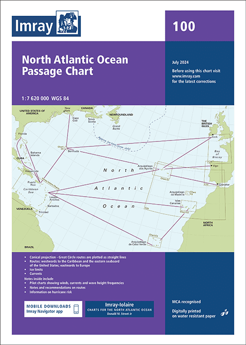
Imray Chart 100 North Atlantic Passage Chart
Imray’s North Atlantic Passage Chart 100 is the definitive planning tool for sailors preparing to cross the Atlantic. Covering the entire North Atlantic Ocean, it is specifically designed to support Atlantic passage planning and provide a clear overview of the major ocean routes used by cruising yachts and commercial vessels alike.
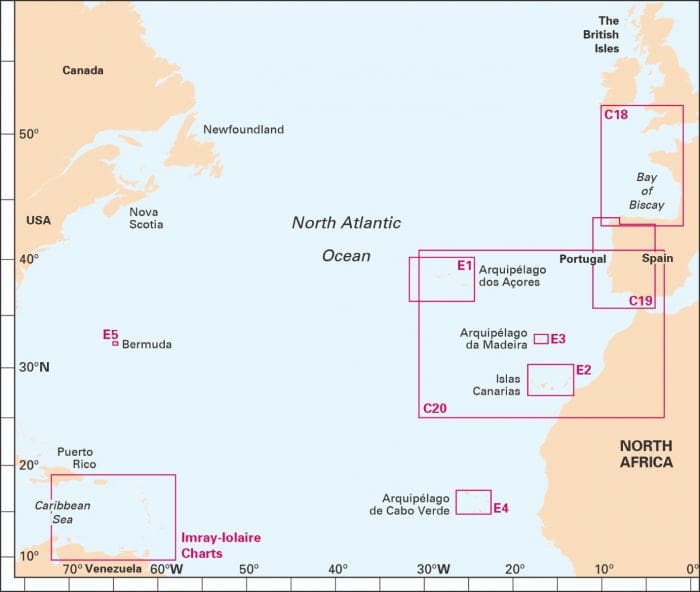
This Atlantic passage chart includes recommended tracks for both eastbound and westbound crossings, seasonal wind roses, and current information to help skippers choose the best time and route for their voyage. From the Canary Islands to the Caribbean, Europe to North America, and routes north to the Azores or south to Cape Verde, the chart sets out the options in a clear, practical format.
Published by Imray, renowned for their high-quality nautical charts, Imray Chart 100 is printed on durable paper stock suitable for onboard use. It is designed not as a navigation chart but as a planning chart, giving sailors the big-picture perspective needed when weighing departure windows, alternate landfalls, and the influence of prevailing conditions.
Used in conjunction with pilot guides such as World Cruising Routes, this chart is an invaluable addition to the chart table of any yacht preparing for bluewater cruising. Whether you’re crossing with the ARC, planning a return voyage from the Caribbean, or dreaming of your first ocean passage, the Imray Chart 100 provides the essential overview to make informed decisions.
Key Features:
-
Complete Atlantic passage chart for planning ocean crossings
-
Recommended tracks for eastbound and westbound routes
-
Seasonal wind roses and current data for passage planning
-
Covers routes via Azores, Canaries, Cape Verde, Caribbean & Bermuda
-
Durable Imray chart format for onboard use
-
Ideal companion to World Cruising Routes
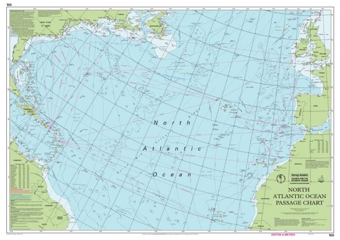
At a scale of 1:7,620,000, Imray Chart 100 covers the North Atlantic from Brazil to Newfoundland and Gibraltar to the Caribbean. It has been constructed on a conical projection that means that Great Circle tracks can be plotted as straight lines rather than curves. Chart 100 shows the main trend of depth contours, limits of ice, magnetic variations and keys routes as identified by Donald M. Street Jr.
In the enclosed booklet are pilot charts showing winds, currents and wave height frequencies with accompanying notes on favourable route timings and hurricane risk. Chart 100 is an important companion for Atlantic yachtsmen on passage and an excellent source of planning information.
For this edition the magnetic variation curves have been replaced by a web link directing sailors to up to date information. The monthly diagrams indicating meteorological seasonal variations have been changed from March, June, September and December to May, June, November and December.

Reviews
There are no reviews yet.