Mastering Cross Atlantic Routes: Top Navigation Tips for a Safe Ocean Voyage
Navigating the open waters on cross Atlantic routes can be both exhilarating and challenging. Whether you’re a seasoned sailor or planning your first ocean voyage, preparation is key to ensuring a safe and smooth journey across one of the world’s most iconic stretches of sea. From understanding weather patterns to mastering navigation tools, there’s a lot to consider before setting sail. In this guide, we’ll walk you through essential tips and strategies to help you confidently chart your course, avoid common pitfalls, and make the most of your adventure across the vast Atlantic. Ready to dive in? Let’s get started!
Understanding Weather Patterns and Ocean Currents
When planning cross Atlantic routes, understanding weather patterns and ocean currents is essential. These factors can greatly impact both the safety and efficiency of your voyage. Knowing how to read weather charts and navigate through changing conditions helps you avoid dangerous situations, like storms or strong winds.
Weather charts provide crucial data that reveal upcoming changes in wind speed, pressure systems, and storm fronts. Learning to interpret these charts ensures you’re prepared for any sudden shifts in weather. It’s important to check these charts frequently, especially during long journeys across open waters where conditions can change unexpectedly.
Wind patterns also play a major role when sailing across the Atlantic. Winds tend to move in predictable ways depending on the time of year and region. For example, trade winds blow from east to west near the equator while westerlies dominate farther north. Picking a route with favorable wind direction can reduce fuel consumption or save energy if you’re sailing without an engine.
Ocean currents must be factored into route planning as well. Currents like the Gulf Stream can either assist or slow down your progress depending on their direction relative to yours. By aligning your path with favorable currents, you can make better time while conserving resources such as fuel or provisions.
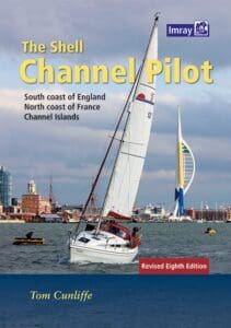
Using tools like Imray Charts allows sailors to visualize these complex elements more effectively during navigation. These physical nautical charts provide detailed information not only about coastlines but also about tidal flows and other navigational hazards along your journey – making them invaluable for both beginners learning marine navigation and experienced captains guiding yachts across vast distances.
By mastering weather patterns and ocean currents with reliable tools at hand, you’ll be better equipped to handle risks at sea while maximizing efficiency during your voyage
Plotting Cross Atlantic Routes with Precision
When planning cross atlantic routes, accuracy is key. One of the most important tools for achieving this is using up-to-date nautical charts. These charts provide vital information about the ocean’s geography, including depth measurements, coastlines, and potential hazards like shoals or reefs. Relying on outdated charts can increase the risk of running into unexpected obstacles that could slow down your journey or even endanger your vessel.
For those navigating boats or yachts across the Atlantic, physical nautical charts such as Imray Charts offer a tangible advantage. Unlike digital systems that rely on signals and power sources, physical charts don’t fail due to electrical issues or signal loss. They serve as an essential backup to electronic navigation systems like GPS. Having a reliable chart allows you to double-check your position against visual landmarks and ensure you’re on track.
Imray Charts have long been trusted by sailors for their detailed precision covering both sea routes and inland waterways. Whether you’re learning marine navigation or teaching it to others, these charts provide critical insights into safe passage planning across open waters. Using them helps plot efficient courses while avoiding dangerous areas like rocky outcrops or shallow waters.
In combination with GPS systems, using updated nautical charts ensures that you stay informed about any changes in underwater topography or shipping lanes along your route. A well-planned course not only saves fuel but also minimizes unnecessary detours caused by poor route planning.
Whether you’re making frequent voyages across the Atlantic or embarking on one for the first time, plotting cross atlantic routes requires careful preparation with trusted tools at hand
Safety Equipment
When navigating cross atlantic routes, safety equipment is essential. Before leaving the shore, ensure your vessel has all the necessary gear to handle emergencies. Life rafts should be on board and in good condition. They provide a critical escape if you need to abandon ship. Make sure they’re stored in easily accessible locations, and check regularly that they haven’t expired or been damaged.
Another important piece of equipment is an EPIRB (Emergency Position Indicating Radio Beacon). This device sends a distress signal if your boat gets into trouble, helping rescue teams locate you quickly. The ocean is vast, and being found without proper communication tools can be difficult. Always test your EPIRB before starting your journey.
Flares also play an important role in signaling for help during emergencies. There are different types of flares—parachute flares for long distances and handheld ones for closer range encounters with nearby vessels or rescue teams. Ensure you know how to use them effectively, as panic can make it harder to follow instructions during a crisis.
A well-stocked medical kit is equally crucial when crossing the Atlantic Ocean. At sea, immediate medical help isn’t always available, so having basic supplies like bandages, antiseptics, and pain relievers could make all the difference while waiting for assistance.
Alongside these items, navigation tools like nautical charts should not be overlooked when planning any long voyage across open waters. Imray Charts offer detailed physical maps that guide sailors through both oceans and inland waterways alike. These charts can aid you in plotting safer courses by showing underwater hazards or tricky currents that electronic systems might miss.
Always remember: thorough preparation reduces risks
Mastering Communication Systems on Board
Communication is key when navigating cross atlantic routes. Reliable tools like satellite phones, VHF radios, and AIS (Automatic Identification System) devices play a crucial role in ensuring safety. These systems allow you to stay in touch with nearby vessels or emergency services during your journey. But to make the most out of these tools, it’s essential to understand how they function and when each should be used.
Satellite phones can be invaluable for long-distance communication while sailing through remote areas where regular mobile coverage isn’t available. They provide a direct link to shore-based teams, giving you the ability to report issues or request help from maritime authorities if needed. On extended voyages across the Atlantic, having this kind of connection is not just helpful—it’s vital.
VHF radios serve another important purpose by allowing short-range communication between boats that might be near you along your route. These radios come in handy for making quick updates about weather conditions or hazards that other vessels may have spotted ahead. In busy shipping lanes or congested harbors, VHF radios allow captains to coordinate movements and avoid collisions.
AIS devices add an extra layer of security by broadcasting your vessel’s position to others around you. This helps nearby ships know where you’re located and vice versa—crucial for avoiding close calls in poor visibility or at night.
To complement these electronic tools, physical navigation aids like Imray Charts remain highly useful aboard any vessel crossing the ocean. Although technology is great, nothing beats having well-detailed charts on hand when plotting courses through unfamiliar waters. For sailors learning marine navigation skills or teaching others onboard, Imray Charts offer precise information that can guide safe passage through even complex routes.
Ensuring proper use of all these systems will significantly improve communication capabilities throughout your voyage across the Atlantic Ocean.
Navigating Cross Atlantic Routes with Confidence
Mastering cross Atlantic routes requires a deep understanding of weather patterns, ocean currents, and precise route plotting. Safety remains paramount, from equipping your vessel with the right gear to ensuring smooth communication on board. As you prepare for your voyage, having reliable tools like Imray Charts can make all the difference. These high-quality nautical charts provide essential guidance for navigating both open seas and inland waterways, helping you chart your course with confidence. Whether you’re a seasoned sailor or learning marine navigation, these charts offer unparalleled accuracy, ensuring that every journey is as safe as it is successful.