Sailing the Isles of Scilly
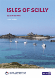
Picture yourself gliding through crystal-clear waters, the gentle sea breeze on your face, and a cluster of enchanting islands on the horizon. The Isles of Scilly offer a unique sailing experience, combining breathtaking scenery with a sense of adventure. Whether you’re an experienced sailor or just starting out, planning your journey is key to making the most of these idyllic waters. Tools like Imray Charts UK can help you navigate safely while uncovering hidden coves and charming harbors. From spotting wildlife to exploring secluded beaches, sailing here is all about discovery and savoring each moment on the water.
Discovering the Isles of Scilly
The Isles of Scilly sit just off the southwestern tip of Cornwall. They attract sailors who seek a unique experience on the water. This group of islands is known for its clear waters, quiet anchorages, and easy access by boat. For those exploring by sea, each island offers something different to enjoy.
Sailing between the islands is straightforward but requires proper planning. The tides and currents in this area can be tricky at times. Using reliable navigation tools like Imray Charts UK helps ensure safe passage through these waters. These charts provide detailed information about routes, depths, and hazards that may not be immediately visible from your boat. Having them aboard allows you to focus on enjoying your journey while staying well-prepared.
Each island in the archipelago has its own character. St Mary’s is often where many sailors begin their adventure since it serves as a central hub with accessible harbors. From there, you can set sail toward Tresco or Bryher for peaceful moorings surrounded by untouched landscapes. Exploring these spots by boat lets you visit places that remain out of reach for most visitors arriving via ferry.
For those learning marine navigation or teaching others how to sail, this area offers plenty of opportunities to practice important skills such as chart reading and route plotting. The manageable distances between islands make it an ideal location to build confidence on the water without venturing too far from safety.
Even experienced sailors find value in having trusted resources when planning trips here. Imray Charts UK help you identify potential obstacles like sandbanks or rocky outcrops that could disrupt your plans if unnoticed. Knowing where to anchor safely also ensures you make the most of calm evenings after a day spent sailing.
Navigational Tips for Safe Sailing
Understanding tides and weather is a key part of sailing around the Isles of Scilly. These waters, while rewarding to explore, can be unpredictable. Tides here shift quickly, affecting both water depth and current strength. Knowing when and where these changes occur helps you avoid trouble. Local tide tables provide detailed information, but pairing them with physical tools like Imray Charts UK adds an extra layer of confidence. These charts give precise details about depths, hazards, and anchorages—information that’s crucial in areas with shifting conditions.
Weather patterns also play a big role in safe navigation. Winds can change direction or speed without much warning in this area. Before setting out, check marine forecasts from trusted sources daily. While apps and digital tools offer convenience, having a reliable backup on board is equally important. This is where Imray Charts UK proves valuable again—they’re not dependent on batteries or signal strength and remain accessible at all times.
Planning your route ahead of time reduces risks during your journey. Plot courses that account for sandbanks and submerged rocks common around these islands. The charts help you spot such hazards early so you can plan accordingly rather than react at the last minute.
Anchoring safely requires careful judgment as well. Some coves may appear calm but could expose vessels to strong currents later in the day due to tidal shifts or wind changes overnight. Using detailed data from Imray Charts UK, you’ll know exactly which spots provide good holding ground for anchors.
Paying attention to these elements ensures smoother sailing experiences through the archipelago’s unique waterways while minimizing potential challenges along the way!
Top Anchorages in the Isles of Scilly
St. Mary’s Harbour is one of the most popular anchorages for sailors visiting the Isles of Scilly. Its location makes it an ideal starting point for exploring nearby islands. The harbour provides good shelter and has facilities to make your stay more comfortable, such as water taxis and access to shops. Many sailors rely on Imray Charts UK to navigate safely into this busy spot, as tidal streams can be tricky here without proper guidance.
Tresco’s New Grimsby Sound is another must-visit anchorage in the Isles of Scilly. This area sits between Tresco and Bryher, offering a calm place to drop anchor while enjoying the surroundings. Accessing this sound requires careful navigation due to hidden rocks and shifting sandbanks, but tools like Imray Charts UK provide clear details that help avoid hazards. Once anchored, you can head ashore to explore Tresco Abbey Gardens or take a short dinghy ride over to Bryher for its peaceful walking trails.
Porth Cressa on St. Mary’s southern side offers a quieter alternative for those looking for less activity than St. Mary’s Harbour. This bay is well-suited for smaller boats looking for a scenic anchorage close to shorelines with easy landing spots. Tidal changes here require close attention, making precise navigation essential—another scenario where Imray Charts UK proves invaluable by providing accurate information about depths and currents.
St Agnes’ Cove is perfect if you’re seeking tranquility away from busier areas like St Mary’s or Tresco’s main sounds. It offers limited space but rewards visitors with stunning views and access to unspoiled beaches nearby. Approaching this cove demands extra care due to its narrow entrance; using reliable nautical tools ensures safe passage.
Each anchorage in the Isles of Scilly presents unique challenges tied closely to tides, seabeds, and wind conditions—making detailed nautical charts indispensable when planning your route or choosing where to stop next during your trip through these islands.
Wildlife Encounters While Sailing
Sailing through the Isles of Scilly offers a chance to see many animals in their natural surroundings. Seals can often be found lounging on rocks or swimming nearby. They sometimes pop their heads out of the water, curious about passing boats. Puffins, with their colorful beaks, can be seen during certain times of the year. These birds nest on some of the smaller islands and cliffs, making them a highlight for many sailing trips.
Dolphins may also appear as you sail around these waters. They might swim alongside your boat for short periods, creating memorable moments for anyone onboard. The Isles of Scilly’s environment supports this kind of marine life because the waters here remain relatively undisturbed compared to busier areas.
Having reliable navigation tools is useful when exploring spots where wildlife is most active. Imray Charts UK provides detailed guides that help sailors find safe routes while staying close to areas known for animal sightings. These charts make it easier to plan your journey without missing key locations where seals or puffins might gather.
Bird enthusiasts will appreciate other seabirds that call these islands home too. Gulls and terns frequently soar overhead or rest near sheltered bays. Each part of the Isles has its own unique ecosystem worth exploring by boat.
The calm waters also make it easier to observe underwater activity from your vessel’s deck if conditions allow. Using tools like Imray Charts UK, you can navigate confidently while focusing on spotting wildlife rather than worrying about unknown hazards in unfamiliar areas.
Cultural Gems on Shore
Stepping off your boat in the Isles of Scilly, you’ll find much more than scenic views. The islands hold a rich history and traditions that can be explored through their villages, landmarks, and food. Each stop on land offers something unique to those curious about the culture here. Walking through the narrow streets of St. Mary’s or Tresco, for example, reveals how life has shaped itself around the sea over centuries.
Local museums provide insight into the islanders’ relationship with maritime life. They showcase artifacts from shipwrecks and stories of past sailors who braved these waters. These tales connect visitors to the long-standing bond between locals and the ocean. For anyone navigating these islands today—whether by boat or yacht—understanding this heritage adds depth to your journey.
Ancient ruins scattered across different islands hint at lives lived long ago. Sites like Bant’s Carn burial chamber offer glimpses into prehistoric times. Exploring these locations makes it clear that people have been drawn to this remote archipelago for thousands of years.
Food is another way to experience local life here. Simple ingredients sourced from both land and sea form traditional dishes served in small cafés or pubs along the shorelines. Fresh crab sandwiches or locally caught fish reflect how deeply connected daily meals remain to what surrounds these communities.
For sailors visiting these cultural spots in person, having accurate navigation tools is essential. Imray Charts UK helps ensure smooth sailing between each island destination while also aiding in safe anchoring near points of interest ashore.
Best Time to Sail
Planning your trip to the Isles of Scilly is key when it comes to enjoying smooth sailing conditions and making the most of your time on the water. The ideal period for setting sail falls between late spring and early autumn. These months provide calmer seas, lighter winds, and longer daylight hours—perfect for navigating this unique destination by boat or yacht.
Late spring offers a great opportunity to enjoy milder weather without encountering peak-season crowds. Seas during this time tend to be less turbulent, which is particularly helpful for those who may be new to sailing or prefer an easier journey. This period also provides ample daylight hours, giving sailors more flexibility in planning their routes and anchoring points.
Summer months bring warmer waters and more consistent weather patterns, making them attractive for both experienced sailors and beginners alike. Longer days give you extra time to explore hidden coves or nearby islands at a relaxed pace. Using tools like Imray Charts UK can help you identify safe routes while highlighting interesting areas worth visiting along the way. These charts offer reliable navigation details that make it easier to traverse unfamiliar waters confidently.
Early autumn is another favorable window for sailing around these islands. During September, sea temperatures remain comfortable from the summer warmth, while winds typically stay steady enough for enjoyable journeys under sail. Crowds thin out as schools reopen, allowing a quieter experience onshore if you plan stops at any harbors or beaches.
Whichever part of this season you choose, preparation remains critical. Reliable nautical resources such as Imray Charts UK ensure safer navigation through channels where tides can shift quickly. They’re especially useful when planning routes ahead since they highlight crucial information about hazards or anchorages specific to these waters.
Charting Your Course to Adventure
Exploring the Isles of Scilly by sail offers a unique blend of natural beauty, rich culture, and unforgettable wildlife encounters. From safe navigation tips to discovering the best anchorages, this destination promises an enriching experience for sailors of all levels. Whether you’re timing your trip to enjoy calm seas or immersing yourself in local history ashore, preparation is key to making the most of your journey. Reliable navigation tools, such as Imray Charts UK, play a vital role in ensuring a safe and seamless adventure. With these charts at hand, you’re equipped to navigate confidently and embrace every moment at sea.


