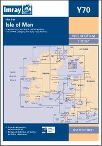
Description
Imray Chart Y70: Isle of Man – Your Essential Navigation Guide for Safe and Efficient Sailing
Explore the waters around the Isle of Man with precision using Imray Chart Y70: Isle of Man. This meticulously crafted chart provides sailors and boating enthusiasts with all the crucial information needed for safe and efficient navigation around this unique maritime region. Imray’s trusted expertise ensures you have the most accurate and up-to-date data for your voyage.
Key Features:
- Comprehensive Coverage: Offers detailed information on the Isle of Man, including depths, navigation aids, and potential hazards, ensuring safe passage.
- High-Quality Cartography: Features clear, easy-to-read graphics and a user-friendly layout, enhancing your navigation experience.
- Latest Updates: Includes the most recent updates and corrections, providing you with the most reliable data for your journey.
- Enhanced Safety: Highlights critical navigation details such as tidal streams, safe anchorages, and important landmarks, helping you avoid hazards and plan your route effectively.
- Durable Design: Printed on high-quality, waterproof paper, making it resistant to wear and tear and suitable for all weather conditions.
- Comprehensive Data: Provides detailed information on port facilities, tidal flows, and local navigational aids, essential for thorough passage planning.
Why Choose Imray Chart Y70: Isle of Man?
- Trusted Brand: Imray is renowned for its precision and reliability in marine cartography, trusted by sailors and navigators worldwide.
- Essential Navigation Tool: Ensures safe and efficient navigation around the Isle of Man with all the necessary details for a worry-free boating experience.
- Up-to-Date Information: Reflects the latest updates and corrections, keeping you informed of any changes in the maritime environment.
- Durable and Practical: Designed to withstand the harsh marine environment, ensuring long-term durability and reliability.
Ideal For:
- Sailors and Boaters: Perfect for those navigating the waters around the Isle of Man, offering essential information for a safe and efficient journey.
- Marine Professionals: An invaluable tool for professional mariners who require accurate and reliable charts for their operations.
- Navigation Enthusiasts: Ideal for boating enthusiasts and coastal explorers seeking detailed and precise navigation information.
Navigate the waters around the Isle of Man with confidence using Imray Chart Y70. Order now to secure this essential navigation chart and ensure a safe and enjoyable boating experience in this unique maritime region.
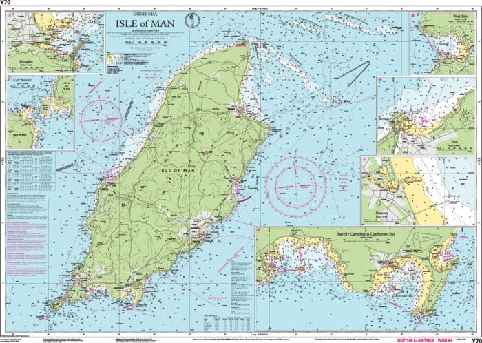
Covers the whole of the Isle of Man. Scale 1:85,150. Larger scale plans of Douglas, Calf Sound, Port Erin, Peel, Ramsey, Bay Ny Carrickey & Castletown Bay.
PRODUCT INFORMATION
- Stock code: ICY70
- Author: Imray Y Series
- Publication details: 640 x 900mm folded to A4, Water-resistant paper chart in plastic wallet or flat on request
- Edition date: 2006
- Printed and updated to: September 2009
- ISBN: 9780852889916
Corrections: https://www.imray.com/media/2scldlme/icy70-n.pdf
Reviews
There are no reviews yet.