Description
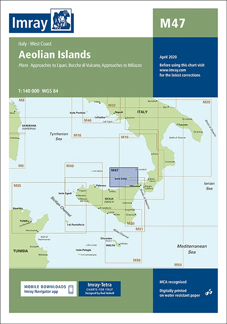
Imray Chart M47 Aeolian Islands – Navigate the Stunning Aeolian Archipelago with Precision
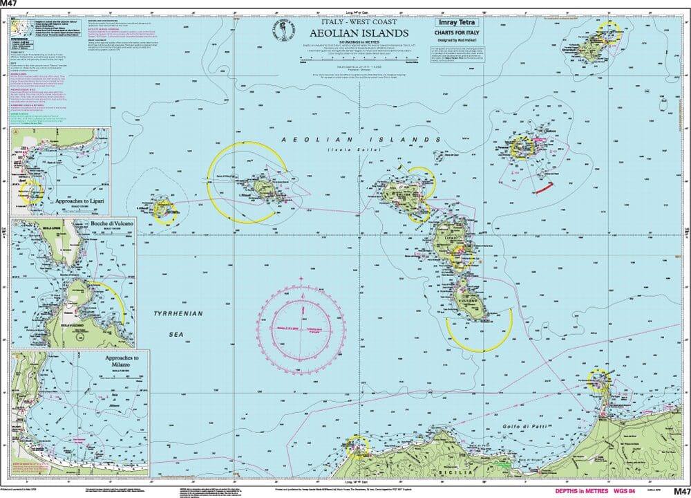
Explore the captivating Aeolian Islands with the Imray Chart M47 Aeolian Islands. This essential navigation chart offers comprehensive coverage of one of the Mediterranean’s most beautiful and diverse archipelagos. Ideal for sailors, cruisers, and yachters, this chart provides the detailed information needed for safe and enjoyable navigation in this unique and picturesque region.
Key Features:
- Detailed Coverage: Features thorough charting of the Aeolian Islands, including Lipari, Vulcano, Stromboli, Salina, Panarea, Alicudi, and Filicudi, as well as the surrounding coastal areas.
- Accurate Navigation Data: Includes precise soundings, tidal information, and navigational hazards to ensure safe passage through the archipelago’s varied and sometimes challenging waters.
- Clear and Easy-to-Read Cartography: Imray’s high-quality cartography provides clear, detailed markings and labels, making it simple to plot your course and identify key features.
- Durable & Water-Resistant: Printed on durable, water-resistant paper, this chart is designed to withstand the marine environment and provide reliable performance throughout your voyages.
- Up-to-Date Information: Incorporates the latest updates and navigational changes to ensure your chart remains current and accurate.
Why Choose Imray Chart M47?
- Trusted Accuracy: Imray charts are renowned for their precision and reliability, making them the preferred choice for both professional mariners and recreational sailors.
- Enhanced Safety: Provides all the necessary information to navigate the stunning yet complex waters of the Aeolian Islands, helping to avoid hazards and find safe anchorages.
- Ideal for Planning: Perfect for planning day trips or extended cruises around the Aeolian Islands, offering detailed guidance for effective route planning and navigation.
- Compact & Practical: Designed for easy folding and storage, making it a practical addition to any navigator’s equipment.
Ideal For:
- Sailors & Yachters: Essential for those navigating the Aeolian Islands, providing detailed coverage of this beautiful and historically significant archipelago.
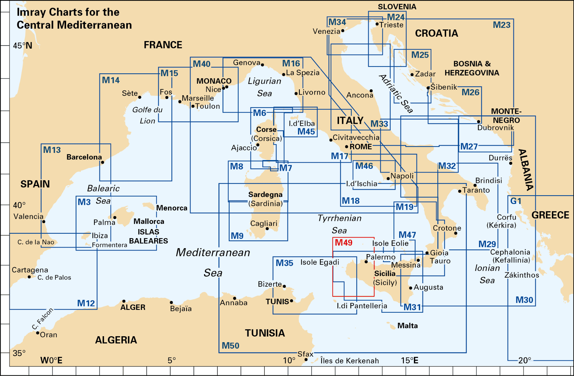
- Mediterranean Cruisers: Ideal for those exploring the Tyrrhenian Sea and seeking detailed information on one of the Mediterranean’s most popular cruising destinations.
- Charterers & Day-Trippers: Perfect for anyone renting boats or planning day excursions in the Aeolian Islands, offering reliable and up-to-date navigation data for a safe and enjoyable experience.
Discover the breathtaking beauty of the Aeolian Islands with confidence using the Imray Chart M47 Aeolian Islands. Order now to ensure your maritime adventures are guided by the most accurate and comprehensive navigational tools available.
Plans included:
- Approaches to Lipari (1:25 000)
- Bocche di Vulcano (1:45 000)
- Approaches to Milazzo (1:30 000)
On this 2018 edition a new plan showing the approaches to Milazzo is included. The chart specification has been improved to show coloured light flashes. There has been general updating throughout.
PRODUCT INFORMATION
- Stock code: ICM47-2
- Author: Imray M Series
- Publication details: 640 x 900mm folded to A4, Water-resistant paper chart in plastic wallet or flat on request
- Edition date: 2018
- Printed and updated to: April 2020
- ISBN: 9781786790224
Reviews
There are no reviews yet.