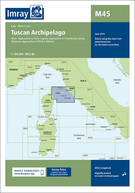
Description
Imray Chart M45 Tuscan Archipelago – Navigate the Enchanting Waters of Tuscany with Confidence
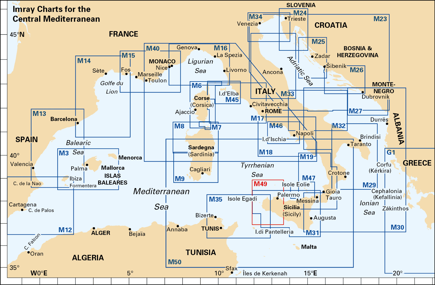
Explore the stunning islands and coastlines of the Tuscan Archipelago with the Imray Chart M45 Tuscan Archipelago. This meticulously detailed chart is an essential tool for sailors, cruisers, and yachters looking to navigate the picturesque waters surrounding Italy’s most beautiful islands. From Elba to Giglio, this chart offers comprehensive coverage to ensure a safe and enjoyable journey.
Key Features:
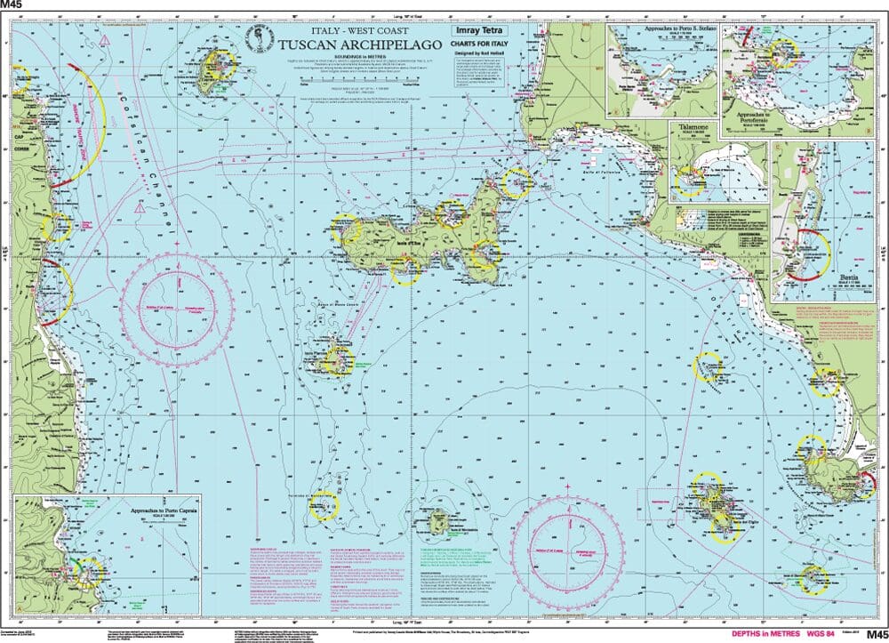
- Detailed Coverage: Provides complete charting of the Tuscan Archipelago, including the islands of Elba, Giglio, Capraia, Pianosa, Montecristo, and Gorgona, as well as nearby coastal areas.
- Accurate Navigation Data: Features precise soundings, tidal information, and marked navigational hazards, giving you the critical information needed for safe passage.
- Clear and Readable Cartography: Imray’s clear and user-friendly cartography makes it easy to plot courses, identify landmarks, and navigate complex coastal waters.
- Durable & Water-Resistant: Printed on high-quality, water-resistant paper, this chart is designed to withstand the rigors of the marine environment, ensuring reliability on all your voyages.
- Regularly Updated: Incorporates the latest navigational updates and changes, ensuring you have the most current and accurate information.
Why Choose Imray Chart M45 Tuscan Archipelago?
- Trusted by Mariners: Imray charts are renowned for their precision and reliability, making them the preferred choice of professional and recreational sailors worldwide.
- Enhances Safety: Provides comprehensive information to avoid hazards, find safe anchorages, and navigate the region’s often challenging waters with ease.
- Perfect for Planning: Whether you’re charting a short day trip or an extended cruise through the archipelago, this chart is indispensable for effective route planning.
- Portable & Convenient: Compact and easy to store, this chart is a practical addition to any navigator’s toolkit.
Ideal For:
- Sailors & Yachters: Essential for those navigating the waters of the Tuscan Archipelago, offering detailed guidance through some of the Mediterranean’s most scenic and historic areas.
- Mediterranean Cruisers: Ideal for those cruising the Mediterranean, especially those keen to explore Italy’s beautiful Tuscan coastline and islands.
- Charterers & Day-Trippers: Perfect for those renting boats or planning day excursions, providing reliable and up-to-date information for a safe and enjoyable experience.
Discover the enchanting waters of the Tuscan Archipelago with confidence using the Imray Chart M45 Tuscan Archipelago. Order now to ensure your sailing adventure is safe, well-planned, and truly memorable.
Plans included:
- Approaches to Porto Capraia (1:25 000)
- Approaches to Portoferraio (1:30 000)
- Bastia (1:17 500)
- Talamone (1:35 000)
- Approaches to Porto S. Stefano (1:15 000)
For this 2015 edition the chart has been fully updated throughout with amendments to navigational aids, cables, restricted areas and harbour developments.
PRODUCT INFORMATION
- Stock code: ICM45-2
- Author: Imray M Series
- Publication details: 640 x 900mm folded to A4, Water-resistant paper chart in plastic wallet or flat on request
- Edition date: 2015
- Printed and updated to: April 2023
- ISBN: 9781846237133
Reviews
There are no reviews yet.