Description
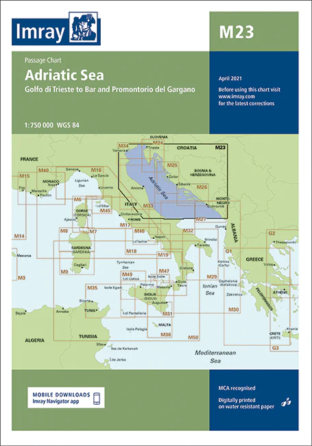
Imray Chart M23 Adriatic Sea Passage Chart – Navigate the Adriatic with Confidence
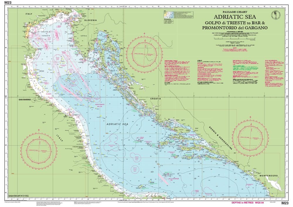
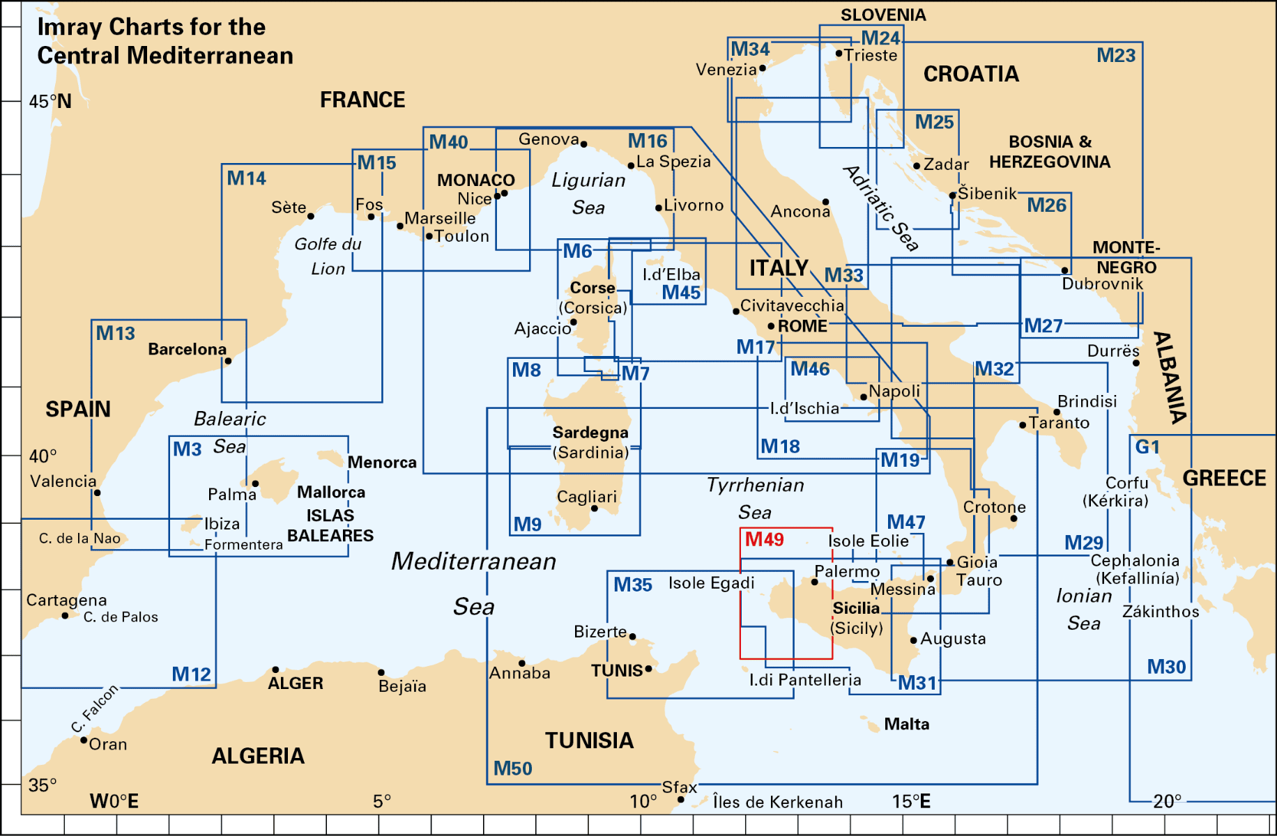
Explore the stunning and varied waters of the Adriatic Sea with the Imray Chart M23 Adriatic Sea Passage Chart. This essential navigation chart provides detailed and accurate coverage of the Adriatic, from the northern reaches near Trieste to the southern regions around Dubrovnik. Ideal for sailors, cruisers, and yachters, it ensures a safe and enjoyable maritime experience in this captivating part of the Mediterranean.
Key Features:
- Extensive Coverage: Comprehensive charting of the Adriatic Sea, including key coastal regions, major ports, harbors, and significant maritime routes from Trieste to Dubrovnik.
- Accurate Navigation Data: Features up-to-date soundings, tidal streams, and navigational hazards, helping you navigate safely through the diverse and scenic waters of the Adriatic.
- Clear & Detailed Cartography: Imray’s high-quality, easy-to-read cartography provides detailed markings and labels, making it straightforward to plot your course and identify important landmarks.
- Durable & Water-Resistant: Printed on robust, water-resistant paper, this chart is built to withstand marine conditions and provide long-lasting performance during your voyages.
- Regular Updates: Includes the latest navigational updates and changes, ensuring you have the most current and accurate information available for your journey.
Why Choose Imray Chart M23?
- Trusted Precision: Imray charts are renowned for their accuracy and reliability, making them a top choice for both professional mariners and recreational sailors.
- Enhanced Safety: Offers essential information to navigate the diverse and picturesque waters of the Adriatic Sea, helping you avoid hazards and locate safe anchorages.
- Ideal for Planning: Perfect for planning both short trips and extended cruises across the Adriatic, providing detailed guidance for effective route planning and navigation.
- Convenient & Portable: Designed for easy folding and storage, making it a practical addition to your navigation toolkit.
Ideal For:
- Sailors & Yachters: Essential for navigating the Adriatic Sea, including major ports and scenic coastal areas, offering detailed information for safe and enjoyable voyages.
- Mediterranean Cruisers: Ideal for those exploring the Adriatic, providing valuable data for navigating one of the Mediterranean’s most beautiful and historic regions.
- Charterers & Day-Trippers: Great for boat rentals and day trips across the Adriatic, ensuring reliable and up-to-date information for a safe and pleasurable maritime experience.
Navigate the breathtaking waters of the Adriatic Sea with confidence using the Imray Chart M23 Adriatic Sea Passage Chart. Order now to ensure your maritime adventures are guided by the most accurate and detailed navigational tools available.
On this edition the chart specification has been improved to show coloured light flashes. The latest information on marine reserves and their extents have been included. The Traffic Separation Schemes (TSS) have been updated. There has been general updating throughout.
PRODUCT INFORMATION
- Stock code: ICM23-2
- Author: Imray M Series
- Publication details: 640 x 900mm folded to A4, Water-resistant paper chart in plastic wallet
- Edition date: 2020
- Printed and updated to: April 2023
- ISBN: 9781786792020


Reviews
There are no reviews yet.