Description
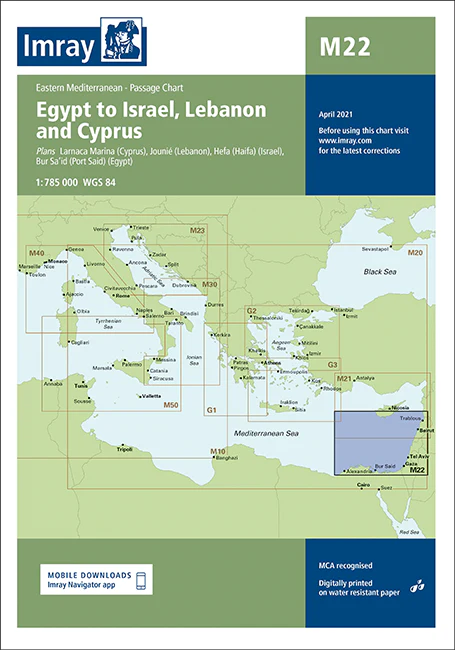
Imray Chart M22 Egypt to Israel, Lebanon, and Cyprus – Navigate the Eastern Mediterranean with Precision
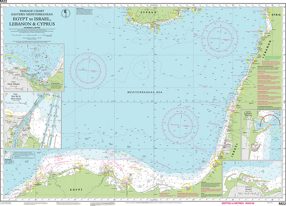
Explore the diverse and historic waters of the Eastern Mediterranean with the Imray Chart M22 Egypt to Israel, Lebanon, and Cyprus. This detailed and essential navigational chart is designed for sailors, yachters, and cruisers navigating the maritime routes between Egypt, Israel, Lebanon, and Cyprus. Whether you’re planning a voyage through these historically rich and culturally diverse regions or simply cruising the stunning Mediterranean coastline, this chart provides the accuracy and information you need for a safe and successful journey.
Key Features:
- Extensive Coverage: Comprehensive mapping of the maritime routes from Egypt through Israel, Lebanon, and Cyprus. Includes detailed charts of key ports, harbors, and coastal features in these historically significant regions.
- Accurate Navigational Data: Features crucial navigational information such as soundings, tidal streams, and navigational hazards. This ensures safe passage through complex waters and busy shipping lanes.
- Imray Cartography: Known for its precision and clarity, Imray’s expert cartography provides reliable and detailed information that is essential for effective navigation.
- Marine-Grade Durability: Printed on water-resistant and tear-proof paper, this chart is designed to withstand the harsh marine environment, ensuring long-lasting use and reliability.
- Up-to-Date Information: Incorporates the latest navigational updates and changes, offering the most current and accurate data available for your maritime adventures.
Why Choose Imray Chart M22?
- Precision and Reliability: Imray charts are globally respected for their accuracy, making them the top choice for mariners who require dependable navigational tools.
- Enhanced Safety: Provides detailed information to help avoid hazards, identify safe anchorages, and navigate through busy and complex waters with ease.
- Ideal for Maritime Exploration: Perfect for planning and executing voyages through the Eastern Mediterranean, offering comprehensive guidance for a successful trip.
- User-Friendly Design: Features a clear and well-organized layout that is easy to read and use, even in challenging conditions.
Perfect For:
- Sailors & Yachters: Essential for navigating the waters between Egypt, Israel, Lebanon, and Cyprus, providing detailed coverage and reliable information.
- Mediterranean Cruisers: Ideal for those exploring the rich cultural and historical regions of the Eastern Mediterranean, ensuring a safe and enjoyable journey.
- Maritime Adventurers: Perfect for anyone planning to navigate the complex and scenic waters of this diverse region, ensuring up-to-date and accurate navigational data.
Navigate the historic and stunning waters of the Eastern Mediterranean with confidence using the Imray Chart M22 Egypt to Israel, Lebanon, and Cyprus. Order today to ensure you have the best navigational aid available for your maritime explorations in this fascinating region.
Plans:
- Jounie (Lebanon)
- Larnaca (Cyprus)
- Hefa (Haifa) (Israel)
- Bur Sa’id (Port Said) (Egypt)
PRODUCT INFORMATION
- Stock code: ICM22-2
- Author: Imray M Series
- Publication details: 640 x 900mm folded to A4, Water-resistant paper chart in plastic wallet
- Edition date: 2018
- Printed and updated to: April 2023
- ISBN: 9781786790378
Reviews
There are no reviews yet.