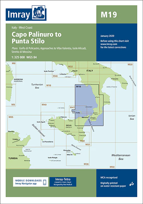
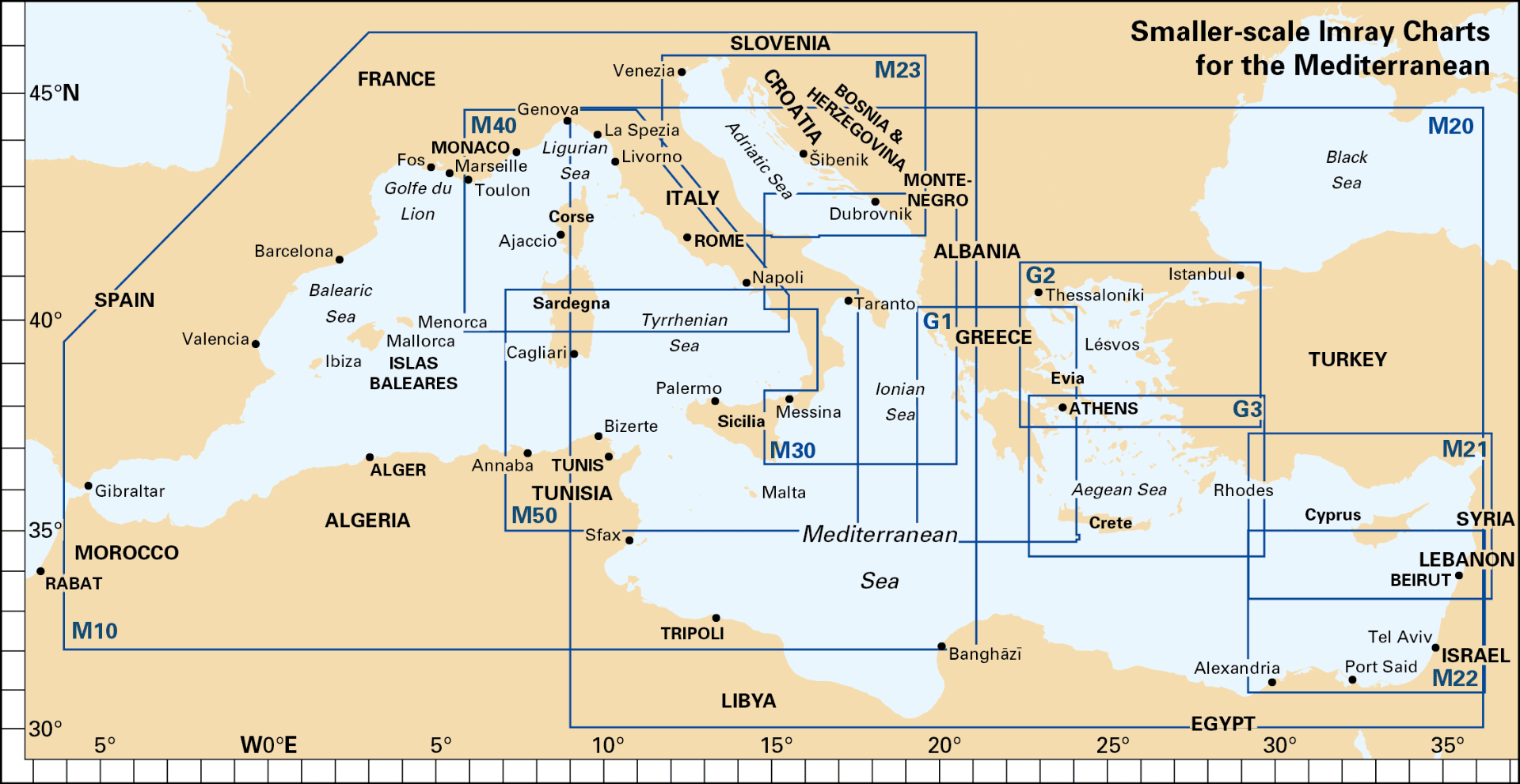
Description
Imray Chart M19 Capo Palinuro to Punta Stilo – Navigate Southern Italy’s Stunning Coastline with Confidence
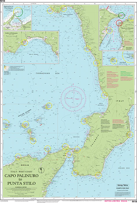
Explore the picturesque and historically rich coastline of Southern Italy with the Imray Chart M19 Capo Palinuro to Punta Stilo. This high-quality navigational chart is an essential tool for sailors, cruisers, and maritime enthusiasts venturing along the Tyrrhenian Sea from Capo Palinuro to Punta Stilo. Known for its accuracy and detail, this chart provides all the information needed for safe and effective navigation in this beautiful Mediterranean region.
Key Features:
- Comprehensive Coverage: Detailed charting of the Southern Italian coast, including key landmarks, ports, anchorages, and harbors between Capo Palinuro and Punta Stilo.
- Accurate Navigation Data: Up-to-date soundings, tidal streams, and navigational hazards are clearly marked, ensuring you have the latest information for safe passage.
- High-Quality Cartography: Imray’s renowned cartographic expertise delivers clear, detailed, and easy-to-read charts that are indispensable for plotting your course and navigating the Tyrrhenian Sea.
- Durable & Water-Resistant: Printed on premium, water-resistant paper, this chart is designed to withstand the challenging marine environment, providing long-lasting reliability during your voyages.
- Regularly Updated: Reflects the most current navigational information and updates, ensuring that you are navigating with the most accurate and reliable data.
Why Choose Imray Chart M19?
- Trusted Precision: Imray charts are known worldwide for their accuracy and dependability, making them a top choice for both professional and recreational mariners.
- Enhanced Safety: Provides essential information for navigating the diverse waters along the Southern Italian coastline, helping you avoid hazards and identify safe anchorages.
- Perfect for Planning: Whether you’re planning a short coastal trip or an extended voyage, this chart offers detailed guidance for effective route planning and navigation.
- User-Friendly Design: The clear and detailed layout makes it easy to use, even in challenging conditions, ensuring that you can navigate with confidence.
Ideal For:
- Sailors & Yachters: Essential for anyone navigating the Southern Italian coastline, offering detailed information on ports, anchorages, and safe passages.
- Mediterranean Cruisers: Ideal for exploring the Tyrrhenian Sea, providing invaluable data for a safe and enjoyable maritime experience in this stunning region.
- Charterers & Day-Trippers: Great for boat rentals and day trips along the Italian coast, ensuring reliable and up-to-date navigational information.
Navigate the captivating Southern Italian coastline with confidence using the Imray Chart M19 Capo Palinuro to Punta Stilo. Order now to ensure your maritime adventures are guided by the most accurate and detailed navigational tools available.
Plans
Golfo di Policastro (1:35,000)
Approaches to Vibo Valentia (1:15,000)
Isole Alicudi (1:200,000)
Stretto di Messina (1:125,000)
On this 2018 edition the chart specification has been improved to show coloured light flashes. Depths have been updated from the latest surveys and the completed works on the Rampion wind farm are shown. There has been general updating throughout.
PRODUCT INFORMATION
- Stock code: ICM19-2
- Author: Imray M Series
- Publication details: 640 x 900mm folded to A4, Water-resistant paper chart in plastic wallet or flat on request
- Edition date: 2018
- Printed and updated to: March 2024
- ISBN: 9781786790934

Reviews
There are no reviews yet.