Description
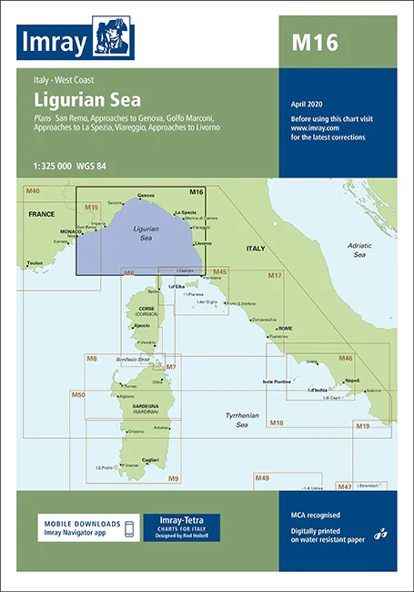
Imray Chart M16 Ligurian Sea – Navigate the Stunning Ligurian Coast with Precision
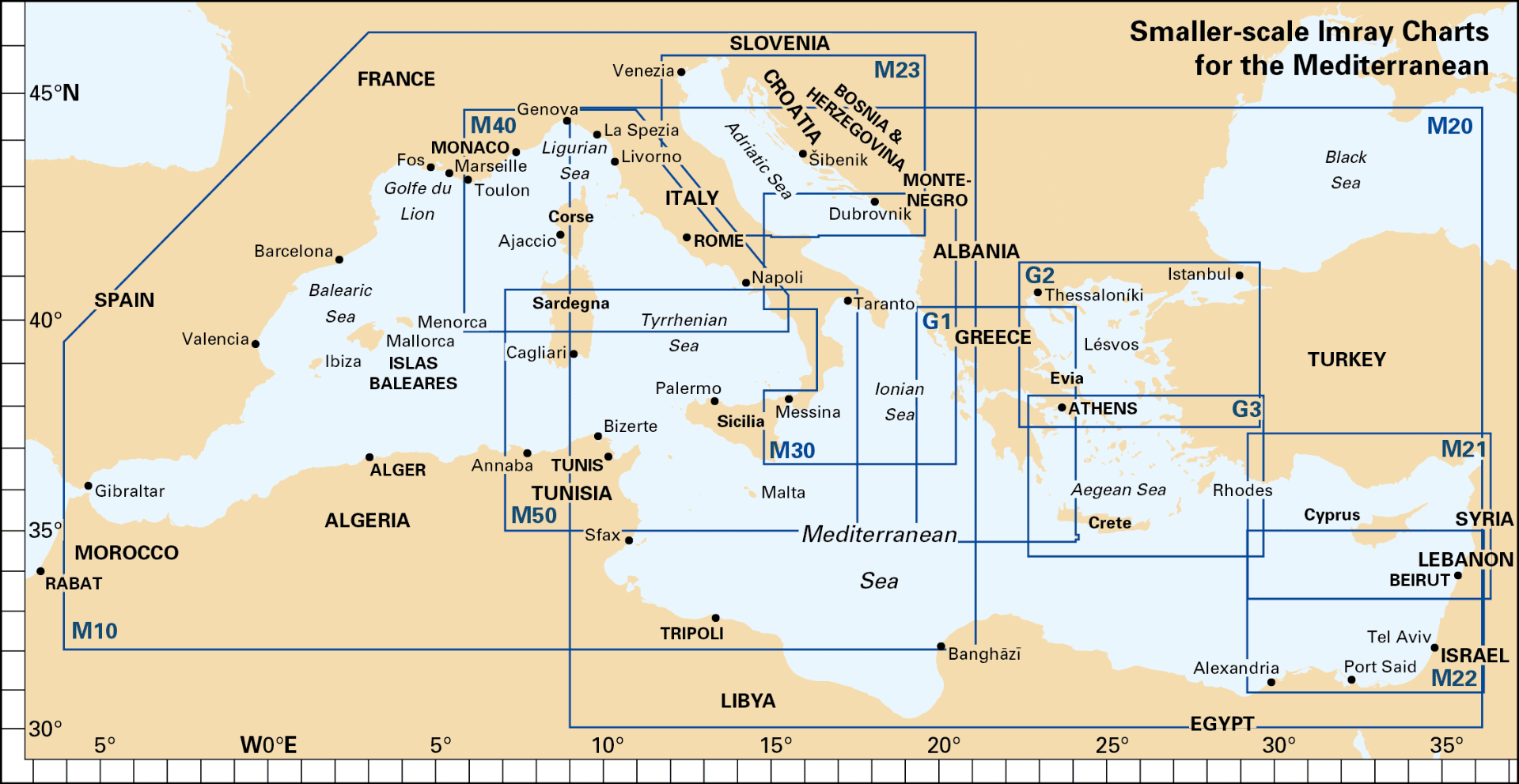
Discover the breathtaking Ligurian Sea with the Imray Chart M16 Ligurian Sea. This essential navigational chart is designed for sailors, yachters, and cruisers exploring the picturesque coastline of the Ligurian Sea, from the French border to the Italian Riviera. Offering comprehensive and detailed coverage, this chart ensures safe and enjoyable navigation through one of the Mediterranean’s most beautiful and sought-after regions.
Key Features:
- Comprehensive Coverage: Detailed mapping of the Ligurian Sea, including the French and Italian coasts, key ports, harbors, and notable cruising destinations. Covers from the French border southward to the Italian Riviera.
- Accurate Navigational Data: Provides essential information such as soundings, tidal streams, navigational hazards, and coastal features, ensuring safe and efficient navigation through complex waters.
- Imray Cartography: Renowned for its accuracy and clarity, Imray charts deliver reliable and detailed information, making them the preferred choice for mariners and cruising enthusiasts.
- Durable Marine-Grade: Printed on water-resistant and tear-proof paper, designed to withstand the marine environment and offer durability for repeated use.
- Up-to-Date Information: Incorporates the latest navigational updates and changes, offering current and relevant data for your journey through the Ligurian Sea.
Why Choose Imray Chart M16?
- Precision and Reliability: Imray charts are globally respected for their accuracy, providing mariners with dependable tools for navigation and route planning.
- Enhanced Safety: Detailed information helps you avoid hazards, find safe anchorages, and navigate through busy and intricate coastal waters with ease.
- Ideal for Coastal Cruising: Perfect for planning and executing voyages along the Ligurian Sea, offering comprehensive coverage of popular ports and scenic coastal areas.
- User-Friendly Design: Features a clear and well-organized layout, making it easy to read and use even in challenging conditions, and ensuring quick and effective navigation.
Perfect For:
- Sailors & Yachters: Essential for navigating the Ligurian Sea, providing detailed charts of the French and Italian coasts and key cruising destinations.
- Mediterranean Explorers: Ideal for those exploring the stunning Ligurian coastline, offering accurate and reliable information for a safe and memorable voyage.
- Maritime Enthusiasts: Perfect for anyone planning to explore the picturesque waters of the Ligurian Sea, ensuring you have up-to-date and comprehensive navigational data.
Navigate the stunning Ligurian Sea with confidence using the Imray Chart M16 Ligurian Sea. Order now to ensure you have the best navigational aid available for your Mediterranean maritime adventures.
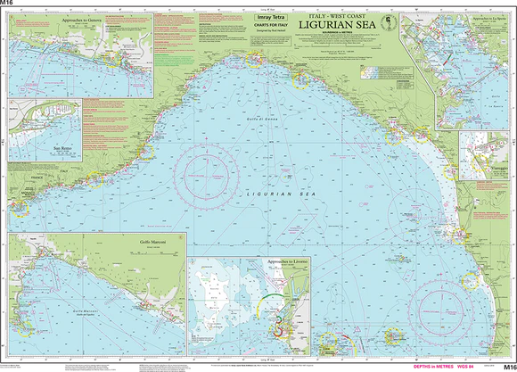
On this July 2016 edition the latest information on firing practice areas is shown, as are the latest details of Marine Reserves. Harbour developments are shown on plans of Livorno, La Spezia and Golfo Marconi.
Plans included:
- San Remo (1:15 000)
- Approaches to Genova (1:75 000)
- Golfo Marconi (1:40 000)
- Approaches to La Spezia (1:37 500)
- Viareggio (1:20 000)
- Approaches to Livorno (1:50 000)
PRODUCT INFORMATION
- Stock code: ICM16-3
- Author: Imray M Series
- Publication details: 640 x 900mm folded to A4, Water-resistant paper chart in plastic wallet or flat on request
- Edition date: 2016
- Printed and updated to: April 2023
- ISBN: 9781846238444
Reviews
There are no reviews yet.