Description
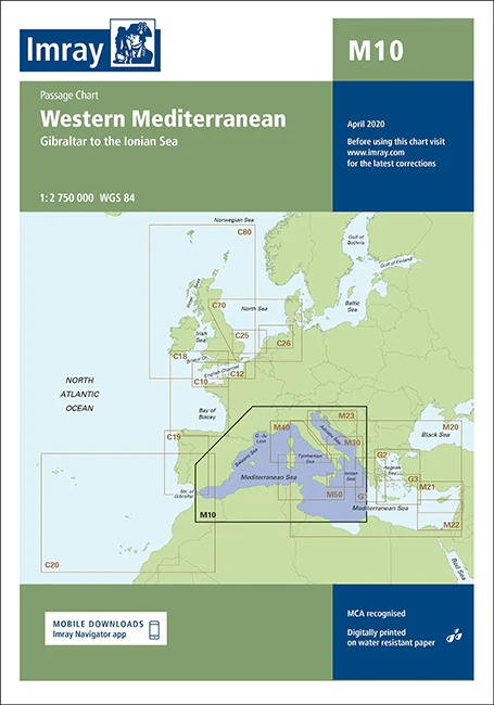
Imray Chart M10 Western Mediterranean – Navigate the Mediterranean’s Best with Confidence
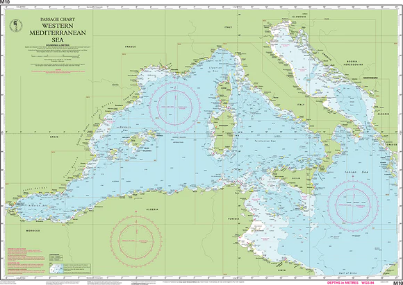
Discover the vibrant and diverse waters of the Western Mediterranean with the Imray Chart M10 Western Mediterranean. This high-quality navigational chart is designed for sailors, yachters, and cruisers exploring the rich maritime routes from Spain through France and Italy. Covering key destinations and popular cruising areas, this chart ensures precise navigation and enhances your maritime experience in one of the world’s most beautiful and historically significant regions.
Key Features:
- Extensive Coverage: Comprehensive mapping of the Western Mediterranean, including the coastlines of Spain, France, and Italy. Features detailed charts of major ports, harbors, and notable cruising areas.
- Accurate Navigational Data: Includes essential information such as soundings, tidal streams, and navigational hazards, providing you with reliable data for safe and efficient navigation.
- Imray Cartography: Renowned for its precision and clarity, Imray charts offer the most accurate and detailed information, helping you plot your course with confidence.
- Durable and Marine-Grade: Printed on water-resistant and tear-proof paper, this chart is built to withstand the marine environment, ensuring long-lasting durability and use.
- Up-to-Date Information: Reflects the latest navigational updates and changes, providing current and relevant data for your journey through the Western Mediterranean.
Why Choose Imray Chart M10?
- Precision and Reliability: Imray charts are globally recognized for their accuracy, making them a trusted choice for mariners needing dependable navigational tools.
- Enhanced Safety: Offers detailed information to help you avoid hazards, find safe anchorages, and navigate complex waters with ease.
- Ideal for Mediterranean Cruising: Perfect for planning and executing voyages through the Western Mediterranean, offering comprehensive coverage of popular cruising areas.
- User-Friendly Layout: Designed with clarity and ease of use in mind, ensuring that you can quickly and effectively navigate even in challenging conditions.
Perfect For:
- Sailors & Yachters: Essential for navigating the Western Mediterranean, providing detailed charts of key destinations and cruising areas.
- Mediterranean Explorers: Ideal for those exploring the scenic coastlines and vibrant ports of Spain, France, and Italy, ensuring a smooth and enjoyable journey.
- Maritime Enthusiasts: Perfect for anyone planning to navigate the diverse and historically rich waters of the Western Mediterranean, offering up-to-date and accurate navigational data.
Navigate the stunning and historically rich waters of the Western Mediterranean with the Imray Chart M10 Western Mediterranean. Order now to equip yourself with the most accurate and reliable chart available for your maritime adventures in this beautiful region.
On this edition the chart specification has been improved to show coloured light flashes. There has been general updating throughout.
PRODUCT INFORMATION
- Stock code: ICM10-2
- Author: Imray M Series
- Publication details: 640 x 900mm folded to A4, Water-resistant paper chart in plastic wallet or flat on request
- Edition date: 2019
- Printed and updated to: April 2023
- ISBN: 9781786791207
Reviews
There are no reviews yet.