Description
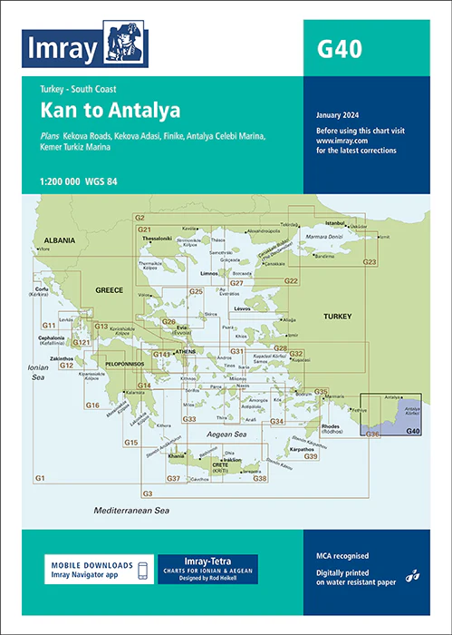
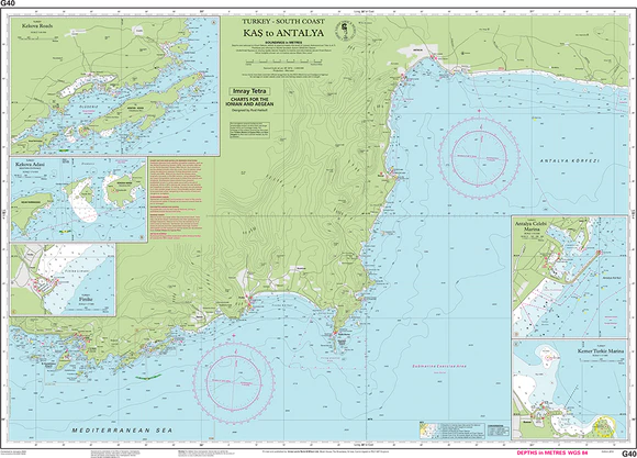
Imray Chart G40: Kas to Antalya
Explore the stunning Turkish coastline from Kas to Antalya with confidence using the Imray Chart G40: Kas to Antalya. This essential nautical chart provides comprehensive coverage of the southern coast of Turkey, highlighting the intricate details of bays, harbors, and anchorages along this popular sailing route. Trusted by mariners worldwide, Imray charts are known for their accuracy and durability, making the G40 an indispensable tool for safe and informed navigation.
Printed on high-quality, water-resistant paper, the Imray Chart G40 is designed to withstand the demands of the sea. It features the latest updates on coastal features, water depths, navigational aids, and potential hazards, ensuring that you have the most current information at your fingertips. Whether you’re planning a leisurely cruise or a more challenging voyage, this chart offers all the details you need for a successful journey.
Key Features:
- Detailed coverage of the southern Turkish coast from Kas to Antalya.
- Includes up-to-date information on harbors, anchorages, water depths, and navigational aids.
- Printed on durable, water-resistant paper to endure harsh marine conditions.
- Ideal for professional mariners, charter operators, and leisure sailors.
- Essential for safe passage planning and navigation in the region.
Equip your vessel with the Imray Chart G40: Kas to Antalya and navigate this beautiful stretch of coastline with precision and peace of mind. Whether you’re an experienced sailor or a casual cruiser, this chart is your reliable guide to the waters between Kas and Antalya.
Plans included:
PRODUCT INFORMATION
- Stock code: ICG40-1
- Author: Imray G Series
- Publication details: 640 x 900mm folded to A4, Water-resistant paper chart in plastic wallet or flat on request
- Edition date: 2014
- Printed and updated to: January 2024
- ISBN: 9781846236297
Reviews
There are no reviews yet.