Description
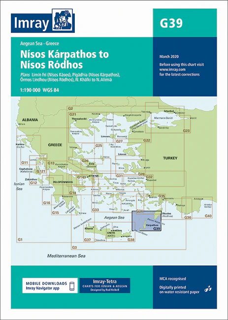
Imray Chart G39: Nísos Kárpathos to Nísos Ródhos
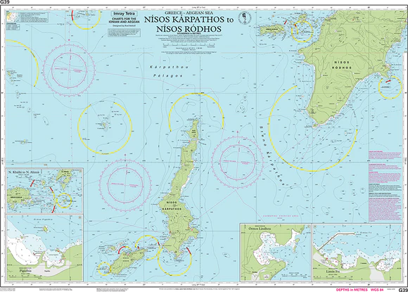
Navigate the waters between Kárpathos and Ródhos with precision and confidence using the Imray Chart G39: Nísos Kárpathos to Nísos Ródhos. This meticulously detailed nautical chart covers the southeastern Aegean Sea, offering crucial information for sailors exploring the Dodecanese Islands and surrounding areas. Renowned for their accuracy and reliability, Imray charts are the preferred choice for mariners seeking safe passage through complex waters.
The Imray Chart G39 is printed on robust, water-resistant paper, ensuring it can withstand the rigors of life at sea. It features the latest navigational data, including updated coastal details, anchorages, harbors, and potential hazards, providing sailors with everything they need to plan and execute their voyage safely. Whether you’re cruising along the scenic coastlines or navigating through the island passages, this chart is an essential tool for your journey.
Key Features:
- Comprehensive coverage from Nísos Kárpathos to Nísos Ródhos in the southeastern Aegean Sea.
- Includes detailed information on harbors, anchorages, coastal features, and navigational hazards.
- Printed on durable, water-resistant paper designed for marine environments.
- Regularly updated with the latest tides, currents, and navigational data.
- Ideal for both experienced sailors and recreational boaters exploring the Dodecanese Islands.
Prepare for your voyage through the Aegean with the Imray Chart G39: Nísos Kárpathos to Nísos Ródhos. Whether you’re an experienced mariner or a casual cruiser, this chart is your reliable companion for safe and accurate navigation in these beautiful yet challenging waters.
Plans :
- Limín Fri (N. Kásos)
- Pigádhia (N. Kárpathos)
- Órmos Líndhou (N. Ródhos)
- N. Khálki to N. Alimiá
PRODUCT INFORMATION
- Stock code: ICG39-1
- Author: Imray G Series
- Publication details: 640 x 900mm folded to A4, Water-resistant paper chart in plastic wallet or flat on request
- Edition date: 2016
- Printed and updated to: March 2020
- ISBN: 9781846238321

Reviews
There are no reviews yet.