Description
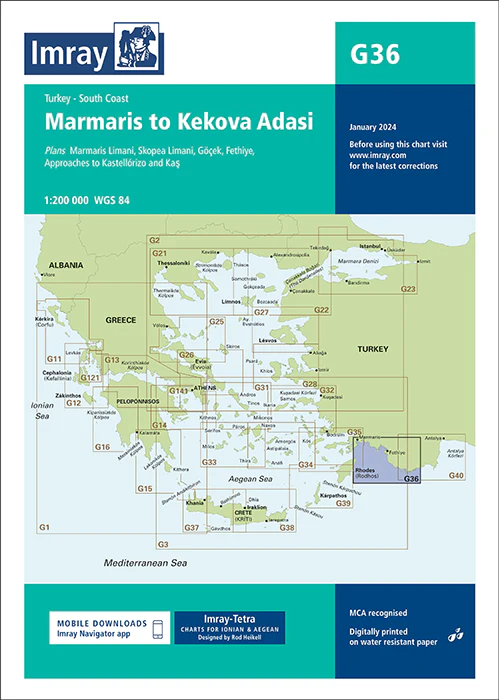
Imray Chart G36 Turkey – South Coast – Your Essential Navigational Guide to the Turkish Riviera
Discover the beauty of the Turkish Riviera with the Imray Chart G36 Turkey – South Coast. This comprehensive navigational chart is an indispensable tool for sailors exploring the stunning southern coast of Turkey, from Antalya to the eastern borders of the Aegean Sea. Whether you’re navigating the turquoise waters of the Mediterranean or visiting historic coastal towns, this chart provides the detailed information you need for a safe and successful voyage.
Key Features:
- Comprehensive Coverage: Detailed mapping of Turkey’s southern coast, including popular destinations such as Antalya, Alanya, Fethiye, and Bodrum. Ideal for planning and executing coastal passages and exploring hidden coves and anchorages.
- Accurate Navigational Data: Includes essential information like depth soundings, tidal streams, navigational hazards, and detailed port plans, ensuring you navigate these waters with confidence and precision.
- Trusted Imray Quality: Known for their accuracy and reliability, Imray charts are the preferred choice for mariners worldwide, offering clear and dependable information.
- Durable and Resilient: Printed on high-quality, marine-grade, water-resistant paper, this chart is designed to withstand the rigors of sea travel, ensuring it remains intact and legible throughout your journey.
- Updated Information: Features the latest updates and corrections, providing you with the most current navigational data available for the southern coast of Turkey.
Why Choose Imray Chart G36?
- Perfect for Coastal Cruising: Whether you’re on a leisurely cruise or a more adventurous passage, this chart offers the detailed information you need to explore Turkey’s south coast safely.
- Safety and Reliability: With precise soundings, hazard markings, and detailed port information, this chart helps you avoid dangers and find safe harbors along the coast.
- Ideal for Explorers: From bustling ports to secluded bays, this chart provides comprehensive coverage of the entire southern coast, making it an ideal tool for sailors looking to explore all that this region has to offer.
Perfect For:
- Sailors & Yachters: Essential for navigating the southern coast of Turkey, providing detailed and accurate information for safe and enjoyable sailing.
- Mediterranean Cruisers: Ideal for those cruising the Mediterranean, offering reliable data for planning and navigating the Turkish Riviera.
- Adventure Seekers: Perfect for explorers seeking to discover the hidden gems of Turkey’s coastline, with detailed information on anchorages and coastal routes.
Embark on your Turkish Riviera adventure with confidence using the Imray Chart G36 Turkey – South Coast. Order now to equip yourself with the most accurate and reliable navigational chart for this breathtaking region.
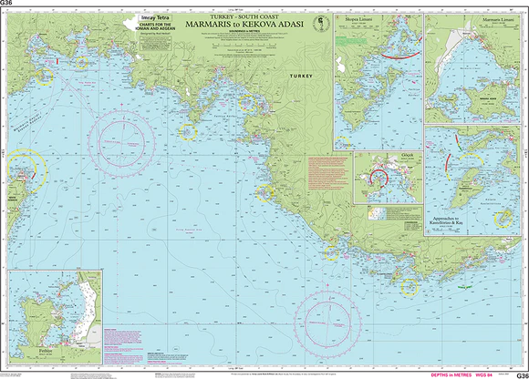
Plans included:
Marmaris Limani (1:50 000)
Skopea Limani (1:100 000)
Göçek (1:25 000)
Fethiye (1:35 000)
Approaches to Kastellórizo and Kaş (1:75 000)
Imray-Tetra charts for the Ionian and Aegean are widely acknowledged as the best available for the cruising sailor. They combine the latest official survey data with first-hand information gathered by Rod and Lucinda Heikell. The chart is designed to be used alongside Imray pilot guides of the area. Like all Imray charts, they are printed on water resistant Pretex paper for durability, and they include many anchorages, facilities and inlets not included on official charts.
This edition includes the latest official data combined with additional information sourced from Imray’s network to make it ideal for small craft. It includes the latest official bathymetric surveys. There has been general updating throughout.
PRODUCT INFORMATION
- Stock code: ICG36-3
- Author: Imray G Series
- Publication details: 640 x 900mm folded to A4, Water-resistant paper chart in plastic wallet
- Edition date: 2022
- Printed and updated to: January 2024
- ISBN: 9781786793539

Reviews
There are no reviews yet.