
Description
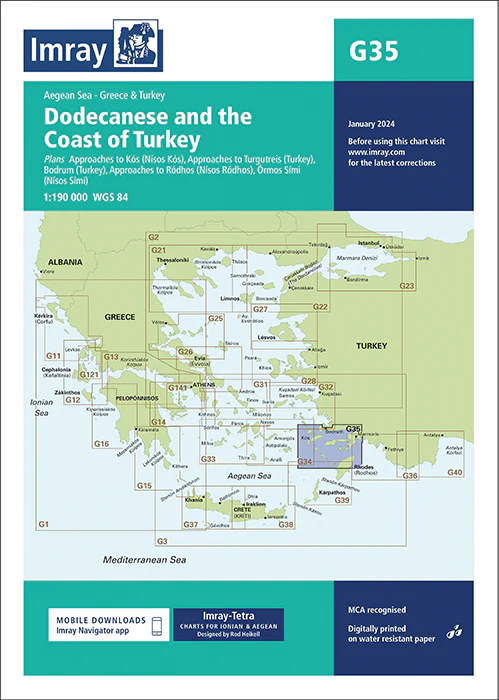
Imray Chart G35 Dodecanese and the Coast of Turkey – Your Essential Guide to Navigating the Aegean
Explore the enchanting waters of the Aegean Sea with the Imray Chart G35 Dodecanese and the Coast of Turkey. This meticulously detailed chart is designed for sailors and yachters who are venturing through the beautiful Dodecanese islands and the stunning Turkish coastline. Whether you’re cruising around Rhodes, Kos, or the Turkish Riviera, this chart offers precise mapping and essential navigational information for a safe and enjoyable voyage.
Key Features:
- Extensive Coverage: Provides comprehensive coverage of the Dodecanese islands, including key locations such as Rhodes, Kos, and Symi, as well as the Turkish coast from Bodrum to Marmaris and beyond. Perfect for planning and executing a multi-destination voyage in this vibrant region.
- Accurate Navigational Data: Includes critical details such as soundings, tidal information, navigational hazards, and detailed harbor plans. This ensures that you can navigate with confidence, avoiding dangers and finding safe anchorages and marinas.
- Renowned Imray Quality: Imray charts are trusted by mariners worldwide for their accuracy, clarity, and reliability, making them an indispensable tool for any serious sailor.
- Durable Marine-Grade Material: Printed on water-resistant and tear-proof paper, this chart is built to withstand the harsh marine environment, ensuring it remains a reliable resource throughout your journey.
- Updated and Current: Features the latest navigational updates, providing you with the most accurate and current information available for sailing in the Aegean.
Why Choose Imray Chart G35?
- Ideal for Aegean Adventures: Whether you’re exploring the historic islands of the Dodecanese or the picturesque Turkish coastline, this chart provides all the navigational data you need for a successful and safe voyage.
- Safety and Precision: The detailed soundings and hazard markings ensure that you can sail through these waters with accuracy, avoiding dangers and reaching your destinations safely.
- Perfect for Island Hopping: Designed for sailors looking to explore multiple destinations, this chart offers detailed information on routes, anchorages, and port facilities across the Dodecanese and Turkish coast.
Perfect For:
- Sailors & Yachters: Essential for navigating the Aegean Sea, providing accurate and detailed coverage of the Dodecanese islands and Turkish coast.
- Aegean Sea Explorers: Ideal for those planning to explore this culturally rich and geographically stunning region, offering reliable information for a smooth journey.
- Mediterranean Cruisers: A must-have for anyone cruising the Mediterranean, ensuring up-to-date and comprehensive navigational data.
Navigate the captivating waters of the Dodecanese and the Turkish coast with the Imray Chart G35 Dodecanese and the Coast of Turkey. Order now to secure the most precise and reliable chart for your Aegean sailing adventures.
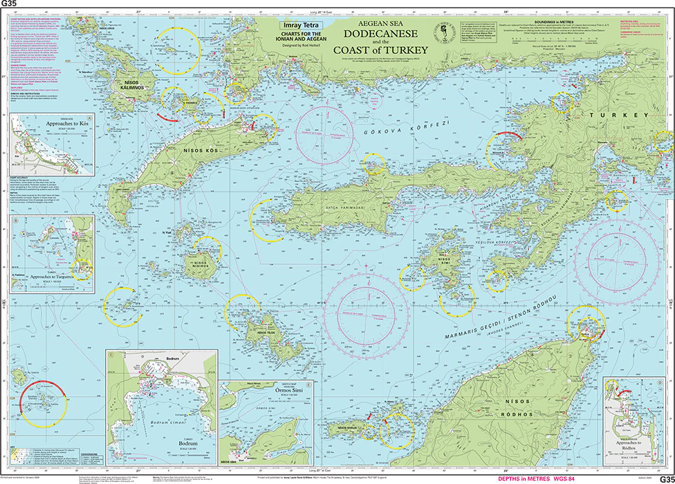
Plans included:
Approaches to Kós (Nísos Kós) (1:20 000)
Approaches to Turgutreis (Turkey) (1:100 000)
Bodrum (Turkey) (1:20 000)
Approaches to Ródhos (Nísos Ródhos) (1:30 000)
Órmos Sími (Nísos Sími) (1:40 000)
Imray-Tetra charts for the Ionian and Aegean are widely acknowledged as the best available for the cruising sailor. They combine the latest official survey data with first-hand information gathered by Rod and Lucinda Heikell. The chart is designed to be used alongside Imray pilot guides of the area. Like all Imray charts, they are printed on water resistant Pretex paper for durability, and they include many anchorages, facilities and inlets not included on official charts.
This edition includes the latest official data combined with additional information sourced from Imray’s network to make it ideal for small craft. It includes the latest official bathymetric surveys. There has been general updating throughout.
PRODUCT INFORMATION
- Stock code: ICG35-3
- Author: Imray G Series
- Publication details: 640 x 900mm folded to A4, Water-resistant paper chart in plastic wallet or flat on request
- Edition date: 2024
- Printed and updated to: January 2024
- ISBN: 9781786795564
Reviews
There are no reviews yet.