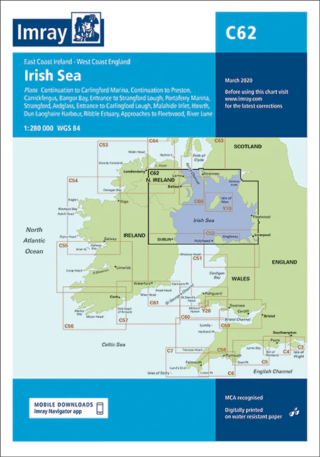
Description
C62 Irish Sea
Plans included:
Carrickfergus (1:15 000)
Bangor Bay (1:17 500)
Entrance to Strangford Lough (1:37 500)
Portaferry Marina (1:7500)
Strangford (1:5000)
Ardglass (1:15 000)
Entrance to Carlingford Lough (1:26 000)
Malahide Inlet (1:35 000)
Howth (1:12 500)
Dun Laoghaire Harbour (1:15 000)
Ribble Estuary (1:125 000)
Approaches to Fleetwood (1:50 000)
River Lune (1:100 000)
Continuation to Carlingford Marina (1:40 000)
Continuation to Preston (1:125 000)
On this edition the chart specification has been improved to show coloured light flashes. Updated bathymetric Digital has been included where available. The firing practice areas have been updated. There has been general updating throughout. PRODUCT INFORMATION
Stock code: ICC62-4
Author: Imray C Series
Publication details: 787 x 1118mm folded to A4, Water-resistant paper chart in plastic wallet or flat on request
Edition date: 2020
Printed and updated to: February 2024
ISBN: 9781786791917
Reviews
There are no reviews yet.